![](/images/other/stat-length.png)
![Tour Wandern Le Bono - Du Bono à la Chapelle de Saint-Avoye - Photo](https://media.geolcdn.com/t/1900/400/ext.pjpeg?maxdim=2&url=https%3A%2F%2Fservices.sitytrail.com%2FGeolivesWS%2FDownloadMedia.ashx%3FTrailID%3D455675%26Media%3Dfix__20150807180035.jpg)
Du Bono à la Chapelle de Saint-Avoye
jeanclaude12
Benutzer
![Länge](/images/other/stat-length.png)
![Maximale Höhe](https://static1.geolcdn.com/siteimages/upload/files/1508320355ic_sort_altitude_max_24dp.png)
![Positive Höhendifferenz](https://static1.geolcdn.com/siteimages/upload/files/1508320355ic_sort_den_pos_24dp.png)
![Km-Effort](/images/other/stat-length.png)
![Min. Höhe](https://static1.geolcdn.com/siteimages/upload/files/1508320355ic_sort_altitude_min_24dp.png)
![Negative Höhendifferenz](https://static1.geolcdn.com/siteimages/upload/files/1508320355ic_sort_den_neg_24dp.png)
![Boucle](https://static1.geolcdn.com/siteimages/upload/files/16400158638029165_repeat_loop_refresh_sync_direction_icon.png)
![Wandern](https://static1.geolcdn.com/sitytour/trail-icons/101.png)
2h47
Schwierigkeit : Einfach
![Scannen Sie diesen QR-Code, um die Tour in der SityTrail-Anwendung zu öffnen](https://capi.geolives.com/qq0zvz2zws4bq2lad0pu/sitytour/trails/455675/qr.png?size=200)
Kostenlosegpshiking-Anwendung
Über SityTrail
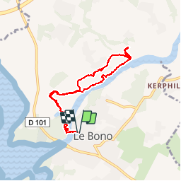
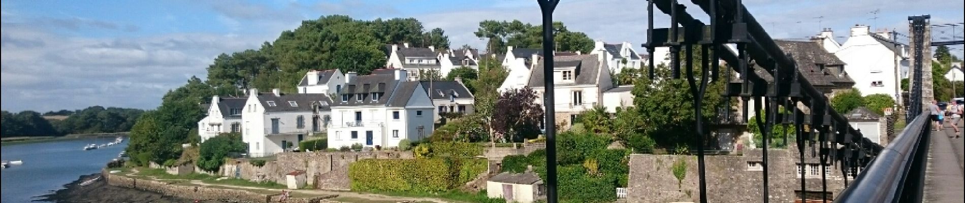
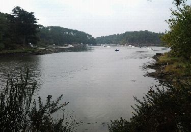
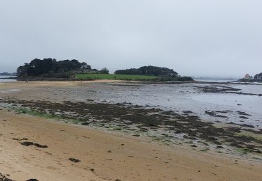
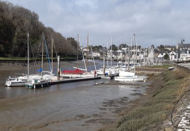
Tour Wandern von 8 km verfügbar auf Bretagne, Morbihan, Le Bono. Diese Tour wird von jeanclaude12 vorgeschlagen.
Beschreibung
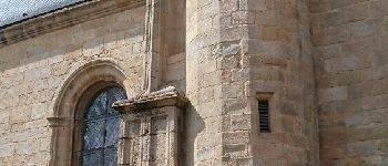
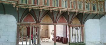
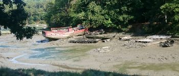
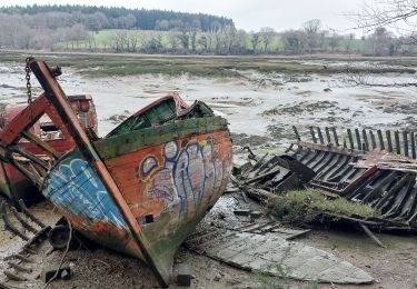
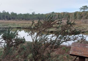
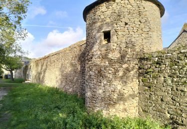
Le parcours longe la rivière du Sal par un sentier côtier bordé de chênes têtards jusqu'à la Chapelle Renaissance du XI ème siècle, chapelle seigneuriale construite par le comte de Lestrelin connue pour son jugé, ses extraits sculptés et. ses couvre-sablières. Le parcours à l'ombre des chênes-têtards fait découvrir un cimetière de bateaux témoignant de l'activité des anciens marins ostréiculteurs du lieu.
Ort
Kommentare
Touren in der Umgebung
![Tour Wandern Pluneret - st Avoye - Photo](https://media.geolcdn.com/t/375/260/ext.jpg?maxdim=2&url=https%3A%2F%2Fservices.sitytrail.com%2FGeolivesWS%2FDownloadMedia.ashx%3FTrailID%3D159588%26Media%3D20121024110349.jpeg)
![Wandern Wandern](https://static1.geolcdn.com/sitytour/trail-icons/101.png)
![Tour Wandern Baden - PR_56_Baden_DA_04_Circuit4a_Pointe-De-Locmiquel_20240317 - Photo](https://media.geolcdn.com/t/375/260/28b1849b-0798-4b99-85e4-eaa3b59fa830.jpg&format=jpg&maxdim=2)
![Wandern Wandern](https://static1.geolcdn.com/sitytour/trail-icons/101.png)
Wandern
![](/images/other/stat-length.png)
![](https://static1.geolcdn.com/siteimages/upload/files/16400158638029165_repeat_loop_refresh_sync_direction_icon.png)
![Tour Wandern Pluneret - PR_56_Pluneret_EA_06_Circuit1b_Tro-Ar-Vourch_20240227 - Photo](https://media.geolcdn.com/t/375/260/5d6bdb50-6a7c-4d72-8e80-1296b3e69841.jpg&format=jpg&maxdim=2)
![Wandern Wandern](https://static1.geolcdn.com/sitytour/trail-icons/101.png)
Wandern
![](/images/other/stat-length.png)
![](https://static1.geolcdn.com/siteimages/upload/files/16400158638029165_repeat_loop_refresh_sync_direction_icon.png)
![Tour Wandern Plougoumelen - PR_56_Plougoumelen_CA_03_Circuit4a_Du-Boterff_20231011 - Photo](https://media.geolcdn.com/t/375/260/d3c418c5-7ec8-4dd5-81ed-a4f492fa39d3.jpg&format=jpg&maxdim=2)
![Wandern Wandern](https://static1.geolcdn.com/sitytour/trail-icons/101.png)
Wandern
![](/images/other/stat-length.png)
![](https://static1.geolcdn.com/siteimages/upload/files/16400158638029165_repeat_loop_refresh_sync_direction_icon.png)
![Tour Wandern Auray - port saint goustan,port bono - Photo](https://media.geolcdn.com/t/375/260/12116764-6d8c-4e87-8742-90bc6f2c0827.jpg&format=jpg&maxdim=2)
![Wandern Wandern](https://static1.geolcdn.com/sitytour/trail-icons/101.png)
Wandern
![](/images/other/stat-length.png)
![](https://static1.geolcdn.com/siteimages/upload/files/16400158638029165_repeat_loop_refresh_sync_direction_icon.png)
![Tour Wandern Pluneret - PR_56_Pluneret_AB_04_Circuit1b_Les-Deux-Rivieres_20230221 - Photo](https://media.geolcdn.com/t/375/260/93c0f218-ebed-477b-bd47-1f60865f1de6.jpg&format=jpg&maxdim=2)
![Wandern Wandern](https://static1.geolcdn.com/sitytour/trail-icons/101.png)
Wandern
![](/images/other/stat-length.png)
![](https://static1.geolcdn.com/siteimages/upload/files/16400158638029165_repeat_loop_refresh_sync_direction_icon.png)
![Tour Wandern Pluneret - PR_56_Pluneret_CA_03_Circuit1b_Anse-Du-Teno_20221120 - Photo](https://media.geolcdn.com/t/375/260/bd8d16df-d91c-4abb-9d2b-d13070c275ca.jpg&format=jpg&maxdim=2)
![Wandern Wandern](https://static1.geolcdn.com/sitytour/trail-icons/101.png)
Wandern
![](/images/other/stat-length.png)
![](https://static1.geolcdn.com/siteimages/upload/files/16400158638029165_repeat_loop_refresh_sync_direction_icon.png)
![Tour Wandern Le Bono - 56-Bono-9km - Photo](https://media.geolcdn.com/t/375/260/d693d4bc-73fd-4dca-9046-40ecea606032.jpg&format=jpg&maxdim=2)
![Wandern Wandern](https://static1.geolcdn.com/sitytour/trail-icons/101.png)
![Tour Wandern Le Bono - PR_56_Bono_AA_01_Circuit1b_La-Riviere-Du-Bono_20220324 - Photo](https://media.geolcdn.com/t/375/260/f25778c3-1356-4ddd-8e62-718d2a61fdc0.jpg&format=jpg&maxdim=2)
![Wandern Wandern](https://static1.geolcdn.com/sitytour/trail-icons/101.png)
Wandern
![](/images/other/stat-length.png)
![](https://static1.geolcdn.com/siteimages/upload/files/16400158638029165_repeat_loop_refresh_sync_direction_icon.png)
Agréable promenade sur ce sentier bien ombragé. Bien agréable sous ces fortes chaleurs.